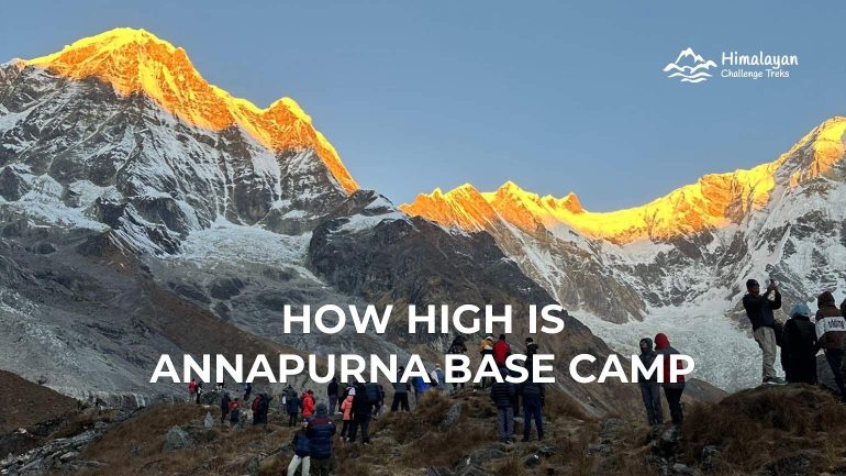
Annapurna Base Camp sits at 4,130 meters (13,550 feet) above sea level. It is the highest point of the standard ABC trek, and it shapes everything: how you plan, pace, and prepare for this route. Geographically, the base camp is located in a glacial basin within the Annapurna Sanctuary, roughly 40 kilometers north of Pokhara. It is surrounded by a ring of peaks above 7,000 and 8,000 meters all around, with the only way in or out through the narrow Modi Khola gorge. That enclosed geography is part of what makes arriving feel unlike most other treks in Nepal.
Quick Overview of Annapurna Base Camp Trek and Its Elevation
The ABC trek is a moderate, non-technical route through the Annapurna Conservation Area in Gandaki Province, central Nepal. Most trekkers complete it in 8 to 12 days from Pokhara. You start at around 820 meters at Pokhara, gain just over 3,300 meters of total elevation across the route, and sleep at 4,130 meters on your base camp arrival night.
The Difference Between Base Camp Elevation and Summit Height
The base camp and the mountain it sits beneath are two very different things. Annapurna I, the world’s tenth-highest peak, reaches 8,091 meters (26,545 feet). The base camp at 4,130 meters is barely halfway up. You are not climbing Annapurna. You are reaching the flat glacial bowl at its foot, where climbers stage their expeditions. The summit is for a different kind of trip entirely.
What Does 4,130 Meters Feel Like?
The high altitude of 4,130 meters is noticeable, but not overwhelming for most people who pace the route correctly. The oxygen is roughly 60% of what it is at sea level. Climbing a short, steep section takes more out of you than it would at home. A poor night’s sleep is more likely. Some trekkers wake with a mild headache. Most manage just fine.
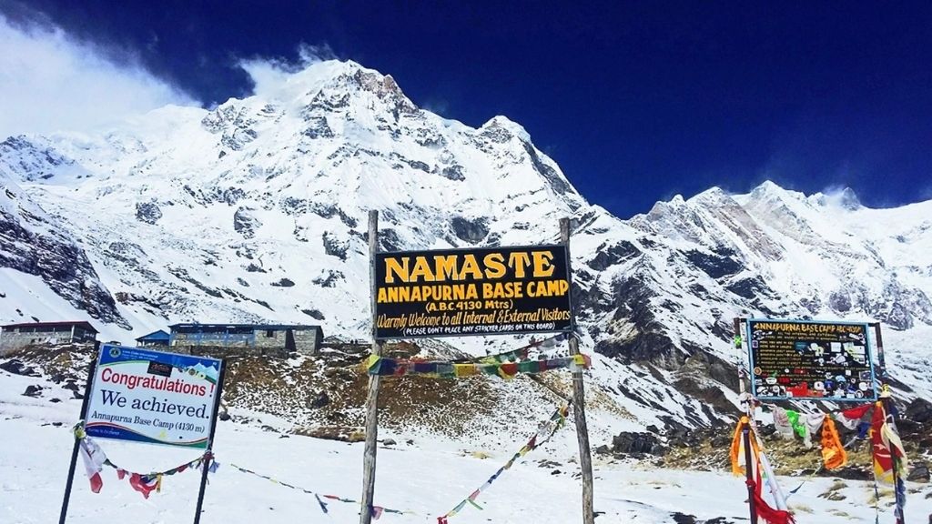
What catches people off guard is how normal it feels on the lower trail, then how quickly the altitude becomes real once you pass Deurali at 3,230 meters. The gorge compresses both the geography and the altitude gain. You are walking from river-valley heat to a snow-ringed glacial amphitheater in three days.
Nighttime temperatures at base camp drop to around -5°C in October and November. It is much colder in winter. So, pack for the cold, not just for the walking.


ABC Trek Altitude Gain Day by Day (11-Day Itinerary)
The route gains altitude in phases. It shapes where your body is most likely to struggle. Understanding the altitude and itinerary will let you know what to expect where.
Phase 1: The Foothills (Low Altitude)
Kathmandu (1,400m) → Pokhara (820m) → Ulleri (2,070m) → Ghorepani (2,874m)

The first two trekking days involve long, steep climbs through terraced farmland and rhododendron forest. The altitude is manageable, but the stone stairways, particularly the notorious climb to Ulleri, are relentless. These starting-day difficulties on the ABC trek are not altitude-related. They are experiencing leg fatigue from cumulative ascent.
Phase 2: The Gradual Elevation Gain
Ghorepani (2,874m) → Poon Hill (3,210m) → Tadapani/Chuile (2,630m) → Chhomrong/Sinuwa (2,170m)
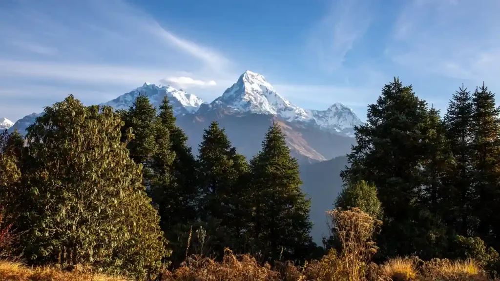
The Poon Hill detour keeps you in the 2,000-3,000-meter band for two days before the gorge push. This is the itinerary’s built-in acclimatization window. You gain height at Poon Hill, descend through Tadapani, and arrive at Chhomrong with legs and lungs that have had time to adjust. Trekkers who rush this section tend to be at risk of altitude sickness and therefore struggle at higher altitudes.
Phase 3: Entering the Sanctuary
Chhomrong/Sinuwa (2,170m) → Himalaya/Deurali (3,230m)
This is the crux. The gorge narrows, the walls close in, and the trail climbs past 2,500 meters into genuine Acute Mountain Sickness (AMS) territory. Deurali marks the entry to the high-altitude zone. For many trekkers, this is where the first real breathlessness kicks in.
Phase 4: The Final Push
Deurali (3,230m) → Machhapuchhre Base Camp (3,700m) → Annapurna Base Camp (4,130m)
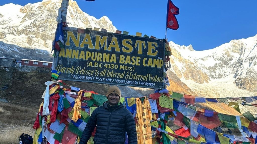
This final push alone is 900-metre total elevation gain. You trek along glacial moraine with Machhapuchhre directly ahead and the first full views of Annapurna I to the left. It is not technically difficult, but it does demand a steady pace and genuine patience.
Is Annapurna Base Camp Too High for Beginners? Fear vs. Reality
No, the majority of fit beginners who follow a proper itinerary and do not rush reach ABC without serious problems. The route’s altitude profile is more forgiving than Everest Base Camp, and the shorter duration means less cumulative exposure. That said, 4,130 meters is not trivial. It is in the high-altitude trekking category, and altitude sickness does not discriminate by fitness level.
Oxygen Level and Breathing at Annapurna Base Camp
At 4,130 meters, available oxygen is roughly 60% of sea-level levels. You will not need a supplemental oxygen cylinder. No trekkers on the standard ABC route carry or use oxygen tanks, excluding the Annapurna expedition. However, you will notice thinner air in day-to-day movement. Climbing stairs in a teahouse at MBC feels different from climbing stairs at Pokhara.
Does the Height of Annapurna Base Camp Cause Altitude Sickness?
Yes, it can. The risk of altitude sickness increases significantly above 2,500 meters, and the ABC gorge route climbs past that mark into a zone where your body has limited time to acclimatize before reaching 4,130 meters. The most common symptoms are headache, fatigue, and disrupted sleep. Serious AMS, HACE, or HAPE is rare on this route but does occur. Knowing the symptoms and being willing to descend if they worsen is not optional.
Tips to Handle 4,130m Altitude on the ABC Trek
Below are some tips to prevent altitude sickness (AMS) above 3,000m on the Annapurna Trail:
- Ascend no more than 300 to 500 meters of net altitude gain per day after crossing 2,500 meters.
- Hydrate consistently, at least three liters of water per day, at higher elevations.
- Avoid alcohol above 3,000 meters. It disrupts sleep and accelerates dehydration.
- Learn the symptoms: persistent headache, nausea, loss of appetite, confusion, and unusual breathlessness at rest are all warning signs.
- Carry altitude sickness medication (acetazolamide/Diamox). It is not a substitute for proper acclimatization, but a useful safety net. Before bringing it, make sure you discuss it with a doctor.
- If symptoms worsen overnight, descend immediately. Do not wait to see if morning is better.
Your guide’s experience matters here. A good guide knows the difference between normal fatigue and early AMS, and will tell you before you have to ask.
Annapurna Base Camp Elevation Profile
Our standard 11-day ABC trek itinerary via Ghandruk and Chhomrong follows this altitude profile:
| Day | Destination | Elevation |
|---|---|---|
| 1 | Kathmandu → Pokhara (drive) | 820 m / 2,690 ft |
| 2 | Pokhara → Ulleri (drive + trek) | 2,070 m / 6,791 ft |
| 3 | Ulleri → Ghorepani | 2,874 m / 9,429 ft |
| 4 | Poon Hill sunrise → Tadapani/Chuile | 2,630 m / 8,629 ft |
| 5 | Tadapani/Chuile → Chhomrong/Sinuwa | 2,170 m / 7,120 ft |
| 6 | Chhomrong/Sinuwa → Himalaya/Deurali | 3,230 m / 10,597 ft |
| 7 | Himalaya/Deurali → MBC → Annapurna Base Camp | 4,130 m / 13,550 ft |
| 8 | ABC → Bamboo (descent) | 2,310 m / 7,579 ft |
| 9 | Bamboo → Jhinu Danda (hot springs) | 1,760 m / 5,774 ft |
| 10 | Jhinu Danda → Pokhara (drive) | 820 m / 2,690 ft |
| 11 | Pokhara → Kathmandu (drive) | 1,400 m / 4,593 ft |
The steep drop on day nine is intentional because the fastest descent is the most effective treatment for altitude sickness, and most trekkers feel significantly better the morning after returning to Bamboo.

What You See at 4,130m: Views from Annapurna Base Camp
The Annapurna Sanctuary is a natural amphitheater. You do not just look at mountains at ABC, you are enclosed by them. Every direction has something above 6,000 meters.
Mountains Visible from Annapurna Base Camp
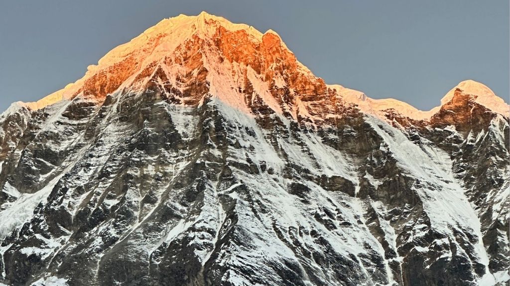
The clearest view from base camp is of Annapurna I (8,091m), the world’s tenth-highest and statistically the most dangerous 8,000-meter peak. To its left, Annapurna South (7,219m) and Hiunchuli (6,441m) lie, while Gangapurna (7,455m) sits to the east. Further, Machhapuchhre (6,993m), whose distinctive fishtail summit is visible throughout the entire final approach, closes off the southern end of the sanctuary. Quick fact: Climbing Machhapuchhre is permanently prohibited because local Gurung people consider the peak sacred.
First Light Over Annapurna I and the Surrounding Giants
Sunrise at base camp is the highlight of the entire trek. At 4,130 meters, the air at 5 AM is thin and cold. Then the peaks begin catching orange light from the east while the basin is still in shadow. The transition from cold grey to gold on an 8,000-meter face, at that altitude, while standing in a snow-dusted glacial bowl, is genuinely difficult to describe to anyone who has not seen it. You will just have to go.
The Glacier Bowl That Surrounds the Base Camp
The basin itself sits on glacial moraine, compacted rock debris left behind by retreating glaciers. The ground is uneven, grey, and mineral. You can see streams of meltwater as you walk by. In October and November, light overnight snowfall coats the upper bowl, but it melts by midmorning. The scale, however, is disorienting. It looks like a short walk to the base of Annapurna I on the map, but in reality involves several hours of difficult terrain. The mountain is simply that large.
Snowfields, Ice Walls, and the Living Glacier Landscape
Above the moraine, the South Face of Annapurna I has one of the most serious avalanche profiles of any 8,000-meter peak. You can hear the mountain wind howling, rushing rapidly, while ice cracks and moves around. Periodic avalanche noise, distant but constant, is part of the ambient sound at base camp. When you near it, you’ll know that this is not a place to underestimate.
How High Is Annapurna Base Camp Compared to Other Treks?
ABC vs Everest Base Camp (EBC): Which Is Harder?
Everest Base Camp sits at 5,364 meters (17,598 feet), 1,234 meters higher than Annapurna Base Camp. That gap matters in several ways. At EBC, oxygen levels are roughly 53% of sea level. At ABC, you are at 60%. The EBC trek is also significantly longer (12 to 16 days vs 7 to 12 for ABC) and reaches higher elevations faster because it starts at Lukla at 2,860 meters via a short flight.

The comparison is not straightforward. When looking closely at ABC and EBC trek. EBC is harder overall due to altitude, duration, and exposure to over 5,000 meters for several consecutive days. But ABC has steeper day-to-day terrain. The stone stairways between Ghandruk and Chhomrong are relentless in a way that the Everest region trails are not. Some experienced trekkers find individual days on the ABC more physically demanding than equivalent days on the EBC route, despite being at a lower altitude.
For a first-time high-altitude trekker, ABC is the better starting point. It tests your body’s response to altitude, delivers the full Himalayan base camp experience, and leaves EBC for a second Nepal trip with real-world experience behind you.
Annapurna Base Camp Compared to Indian Trekking Destinations
Most popular Indian Himalayan treks like Kedarkantha (3,810m), Hampta Pass (4,270m), and Valley of Flowers (3,658m) fall within a similar altitude range to ABC or slightly below it. If you have completed a Hampta Pass or Stok Kangri (6,153m) expedition, the ABC altitude will not surprise your body. If your previous trekking experience is mostly at sub-3,000-meter trail areas in Himachal or Uttarakhand, treat the ABC altitude with respect and follow a conservative itinerary.
Roopkund (4,800m) and Stok Kangri are the Indian treks with meaningful altitude advantages coming into the ABC from India. Everything else in the standard Indian trekking calendar is comparable to or lower than the ABC high point.
Best Time to Trek to Annapurna Base Camp
October is the most consistently recommended month and is widely considered the best time for the trek. Post-monsoon skies over the Annapurna range are the clearest of the year, trails are dry, teahouses are at full capacity, and the mountain views from base camp are unobstructed. The tradeoff is crowds. As October is peak season, popular teahouses between Chhomrong and MBC fill up early.
Spring, specifically April, is the second-best window. Rhododendron forests between Ghandruk and Chhomrong are at full bloom. Temperatures are warmer in the lower sections, and mountain views are clear in the mornings before afternoon clouds build.
The months you should absolutely avoid are June through August. The monsoon brings heavy rainfall, muddy, slippery stone stairs, poor visibility, and leeches in the lower gorge. The ABC trail technically stays open, but the experience is substantially different from what most trekkers are planning for.
Similarly, Winter (December to February) is viable for experienced trekkers with proper cold-weather gear. Trails are quiet, and mountain views on clear days are exceptional. The only problem is that temperatures at base camp drop to -10°C overnight, and snowfall above 3,500 meters can close sections of the trail. The cold also makes it harder to recognize signs of altitude sickness early on.
Conclusion
Lying at 4,130 meters (13,55 0 feet), ABC puts you in high-altitude trekking territory. It is above the threshold where altitude sickness becomes a serious consideration, but below the zone where supplemental oxygen or extreme technical preparation is required. For most physically prepared trekkers who follow a sensible itinerary, the route is achievable. The altitude is the honest variable you need to account for, not eliminate from your thinking.
What you get for that 4,130 meters is one of the more complete mountain environments accessible on foot anywhere in Nepal: a glacial amphitheater ringed by eight-thousand-meter giants, sunrise over majestic peaks like Annapurna I and Machapuchare, and the particular feeling that comes from being enclosed by peaks on all sides. Reaching the base camp makes the altitude challenges worth it.
Find your path to the majestic Annapurna Massif. Choose from our three tailored trekking packages, or contact us to plan your high-altitude adventure.