

The Annapurna Circuit has changed over the years, but it hasn’t lost what made it one of Nepal’s most iconic treks. Roads now extend through much of the lower Marsyangdi Valley on the eastern side and the lower Kali Gandaki Gorge on the western side, replacing sections that once took days to walk. This has made transportation faster and given trekkers the option to skip some lower trails.
However, the heart of the Annapurna Circuit trek remains unchanged. You still experience the dramatic transition from subtropical forests to a high-altitude desert, all of which remain central to the journey across Thorong La Pass (5,416 m), through Manang, and to the sacred site of Muktinath. The Annapurna Circuit continues to offer spectacular Himalayan scenery, authentic Gurung and Thakali villages, and one of the world’s most diverse trekking routes.
Has the Road Really Changed the Annapurna Circuit Trek?
Yes, the road has changed the Annapurna Circuit Trek by changing the approach rather than the difficulty. The change is mainly in the lower sections rather than the trek’s defining highlights.Before road construction, most trekkers walked the entire route from Besisahar through villages that were only accessible on foot. Today, jeep roads connect many of these settlements, allowing trekkers to skip long lower sections and shorten their itinerary.
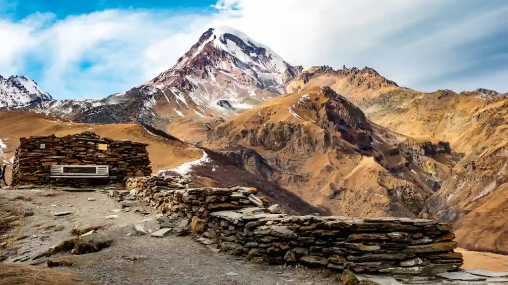
The biggest change is flexibility. Trekkers with limited time can start higher up the valley, while local communities benefit from better transportation and easier access to essential services. Despite these changes, the heart of the trek remains the same. While some lower trails have become quieter, the trek continues to offer spectacular mountain scenery, authentic villages, and one of the world’s most diverse trekking experiences.
Why Was the Road Built Around the Annapurna Circuit?
The road was built mainly to improve daily life for people living in the Annapurna region, not just to support tourism. It provides better access to schools, healthcare, markets, and emergency services while making it easier to transport goods. The project also creates new economic opportunities and improves transportation for both local communities and trekkers.
Economic Benefits for Local Communities
The road has lowered transport costs and made daily essentials like food, fuel, and construction materials more affordable in Manang and Mustang. It has also created new jobs for jeep drivers, mechanics, and roadside businesses, while helping farmers get crops and valuable products like yarsagumba to market more quickly. Although some villages receive fewer walking trekkers than before, the road has brought new economic opportunities.
Better Access to Healthcare, Education, and Supplies
Road access has made everyday life much easier for local communities. Medical emergencies that once required days of carrying patients on foot can now be handled much faster by a jeep, alongside air support from rescue helicopters.”. Schools, health posts, and local businesses are easier to reach, while teachers, healthcare workers, and essential supplies can travel to remote villages more efficiently.
How the Road Has Changed Mountain Villages
The biggest changes can be seen in villages along the road, especially Chame, Bhratang, and areas below Manang. Some teahouses now mainly serve jeep travelers, while others receive fewer overnight trekkers than before. Higher villages such as Manang, Ledar, and the settlements beyond Muktinath toward Kagbeni have changed less, while villages like Ghyaru and Ngawal, which sit above the road, remain quiet and largely untouched by vehicle traffic.

Which Sections of the Annapurna Circuit Have Road Access?
Roads now reach several parts of the Annapurna Circuit, but they don’t cover the entire route. The most important trekking sections, including Thorong La Pass, remain footpaths. Also, note that they are not paved highways. Outside short asphalt sections near Besisahar and Jomsom, they are narrow dirt and gravel tracks carved into steep mountain slopes. Expect dust during the dry season, mud after rain, and occasional delays caused by landslides.
Besisahar to Chame
This is the longest road-accessible section of the Annapurna Circuit, passing through Bhulbhule, Syange, Jagat, Dharapani, and several other villages. Many trekkers take a jeep or local bus to Dharapani or Chame instead of walking this stretch, as it has frequent vehicle traffic and offers fewer mountain views than the higher sections of the trek.
The vehicle traffic along this stretch isn’t just from local jeeps. It is heavily driven by ongoing hydropower station construction along the Marsyangdi River, bringing dump trucks, heavy machinery, and extra mud during wet periods.
Safety Warning — Altitude Acclimatization: Skipping 4-5 days of walking by taking a jeep to Chame or Manang removes your body’s natural acclimatization period. If you take a jeep high up the valley, plan at least two mandatory rest days in Manang (3,540 m) before pushing toward Thorong La Pass (5,416 m) to avoid Acute Mountain Sickness (AMS).Learn more about AMS symptoms, prevention, and treatment in our complete altitude sickness guide.
Chame to Manang
Although a road connects Chame and Manang, most trekkers avoid it by following the traditional high route through Upper Pisang, Ghyaru, and Ngawal. The climb is steeper, but it rewards you with better mountain views, quieter trails, ancient monasteries, mani walls, and traditional stone villages.
Muktinath to Jomsom
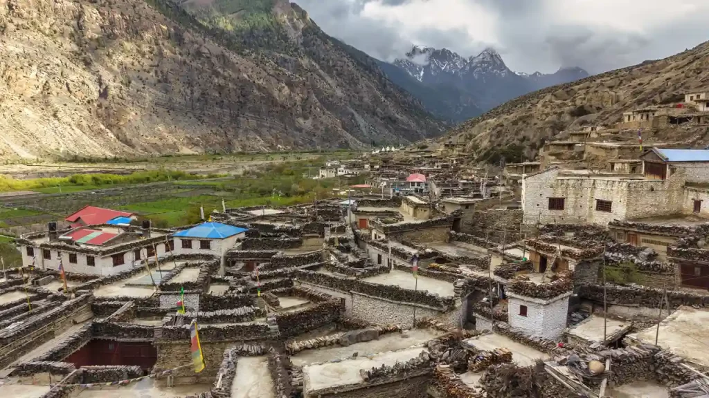
A road links Muktinath and Jomsom through the Kali Gandaki Valley, making this a popular section to travel by jeep, especially after crossing Thorong La Pass. If you prefer to keep walking, the higher trail through Jhong and Purang avoids most of the road while passing through traditional Mustang villages.
Jomsom to Tatopani
This section follows the Kali Gandaki Valley, where jeeps and motorbikes are common. Because much of this section shares the road, many trekkers choose to end their walk at Jomsom and take a jeep or flight directly to Pokhara. Alternatively, trekkers can drive or walk down to Tatopani and continue on foot toward Ghorepani and Poon Hill via quieter mountain trails.
Many trekkers use jeeps to skip these road sections and save time. While this can make the itinerary shorter and more convenient, it also comes with an important trade-off that many first-time trekkers overlook.

Trails That Let You Avoid Most of the Road
As roads expanded across the Annapurna Circuit, local guides and the Annapurna Conservation Area Project (ACAP) developed the Natural Annapurna Trekking Trails (NATT) to help trekkers stay on traditional footpaths. These routes follow old village trails that predate the road and are marked with red-and-white or blue-and-white paint on rocks, trees, and poles.
NATT Trail Markers
- Red & White: Main NATT route
- Blue & White: Alternative or secondary route
Upper Pisang, Ghyaru, and Ngawal
Instead of following the road between Chame and Manang, take the higher trail through Upper Pisang, Ghyaru, and Ngawal. Although the climb is steeper, it rewards you with panoramic mountain views, ancient mani walls, traditional stone villages, and a quieter trekking experience away from vehicle traffic.
Jhong and Purang
After crossing Thorong La Pass, you can avoid much of the road between Muktinath and Jomsom by taking the higher trail through Jhong and Purang. This peaceful route passes through traditional Mustang villages before rejoining the main trail near Kagbeni.
Ghorepani Extension
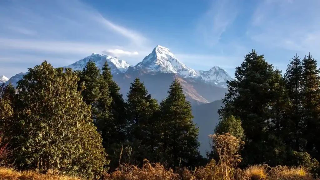
Instead of continuing along the road from Jomsom to Tatopani, many trekkers extend their journey through Ghorepani and Poon Hill. This route replaces dusty road walking with forest trails, terraced hillsides, and one of Nepal’s most famous sunrise viewpoints.
Navigating the NATT Trails
NATT markers are generally easy to follow, but road construction, landslides, and trail maintenance can sometimes cover or remove them. Carrying an offline map such as Organic Maps, Maps.me, or Gaia GPS, or trekking with a licensed local guide, makes it much easier to stay on the footpaths and avoid accidentally rejoining the road.

Road vs Traditional Trails: Which Experience Is Better?
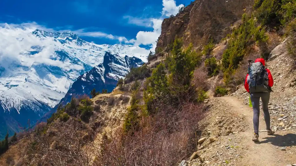
Neither option is objectively better. Using a jeep on the lower road sections is a practical choice if you’re short on time, while the NATT trails offer a quieter and more traditional trekking experience. Many trekkers combine both, taking a jeep where the road is least scenic and following the higher footpaths for the rest of the journey.
| Factor | Road Route | Traditional/NATT Trail |
|---|---|---|
| Speed | Faster, with the option to skip lower sections by jeep | Slower, as most sections are completed on foot |
| Scenery | Valley roads with mountain views, but often dusty | Forest trails, ridgelines, traditional villages, and panoramic views |
| Traffic | Shared with jeeps, motorbikes, and local vehicles | Mostly vehicle-free footpaths |
| Terrain | Dirt and gravel roads, with some walking sections | Stone staircases, forest trails, and traditional footpaths |
| Acclimatization | Faster altitude gain if using a jeep, requiring extra acclimatization | More gradual altitude gain through daily walking |
| Best For | Trekkers with limited time or those wanting a shorter itinerary | Trekkers seeking a quieter, more traditional experience |
| Trade-off | Saves time but includes more road travel | Takes longer but keeps you on classic trekking trails |
To handle the fine glacial dust kicked up by passing jeeps in dry valley corridors like the Kali Gandaki, pack a multi-layer Buff or N95 mask, wrap-around sunglasses, and dry bags to keep silt out of electronics.
How the Road Has Changed the Trekking Experience
The road has brought both advantages and trade-offs to the Annapurna Circuit. While it has improved accessibility and made shorter itineraries possible, it has also changed parts of the traditional trekking experience. Here’s a closer look at its biggest impacts.
Positive Impacts
- Shorter, more flexible itineraries: The Annapurna Circuit can now be completed in 10-12 days instead of the traditional 18-21 days by skipping lower road sections. If you want to continue along the traditional route through Tatopani to Ghorepani and Poon Hill, plan for a full 14–16-day itinerary.
- Greater accessibility: The trek is more accessible for travelers with limited vacation time, families, and those with moderate fitness levels.
- Better logistics: Faster road access makes it easier to combine the circuit with side trips like Tilicho Lake or the road-free Nar Phu Valley.
- Improved services: Better transportation has reduced supply costs, resulting in better-stocked teahouses, more varied menus, and improved access to emergency medical transport.
- New adventure options: The expanding dirt road network has turned the circuit into an internationally recognized route for high-altitude mountain biking and bikepacking over Thorong La Pass.
Negative Impacts
Dust, noise, and traffic: The lower Marsyangdi and Kali Gandaki valleys experience regular jeep and motorbike traffic, especially during the day.
- Fewer traditional walking sections: Some original footpaths have been replaced by roads, reducing the uninterrupted trekking experience.
- Changes to local tourism: Villages along the road receive fewer overnight trekkers as more people travel by jeep.
- Less wilderness on lower sections: Road-accessible stretches feel less remote than they once did, although the high-altitude sections remain largely unchanged.
- Navigation challenges: Without following NATT routes or using offline maps, first-time trekkers may accidentally stay on the road instead of nearby footpaths.
What Local Guides and Experienced Trekkers Say About the Road Impact
Most local guides agree that the goal isn’t to avoid the road completely, but to use it strategically. Many recommend skipping the busiest lower sections by jeep before following the NATT trails through Upper Pisang, Ghyaru, Ngawal, and other quieter routes. This approach saves time while preserving the best scenery and traditional trekking experience.
Experienced trekkers also point out that while the roads have changed parts of the circuit, they have greatly improved life for local communities by providing better access to healthcare, education, markets, and transportation. For many, the Annapurna Circuit is no longer about avoiding every road but about finding the right balance between convenience and the classic trekking experience.


How to Avoid Road Walking Without Missing the Best Scenery
You don’t need to avoid the road completely to enjoy the Annapurna Circuit. Most experienced guides recommend using jeeps strategically on the busiest road sections while following the NATT trails wherever possible. This approach saves time without missing the trek’s best scenery.
- Start your trek from Dharapani or Chame: Skip the longest and busiest road section between Besisahar and Chame.
- Follow the NATT high route: Walk through Upper Pisang, Ghyaru, and Ngawal instead of following the lower road to Manang.
- Take the Jhong-Purang trail: After Muktinath, use this higher route to reach Kagbeni while avoiding much of the road to Jomsom.
- Choose the Ghorepani extension: Instead of walking the road from Jomsom to Tatopani, continue toward Ghorepani and Poon Hill for quieter trails and better scenery.
- Use a guide or offline maps: A licensed guide or apps like Organic Maps, Maps.me, or Gaia GPS make it much easier to stay on the NATT trails where road construction has altered the original route.
Is the Annapurna Circuit Still Worth It After the Road Construction?
Yes. Although roads now reach parts of the lower valleys, the Annapurna Circuit’s most memorable sections remain largely unchanged. You’ll still cross Thorong La Pass, trek through the high villages of Manang, visit the sacred site of Muktinath, and experience the dramatic transition from lush forests to the arid landscapes of Mustang.
The road has changed how people experience the trek, not what makes it special. By following the NATT trails, taking higher routes like Ghyaru and Ngawal, and using jeeps only where they make sense, you can still spend most of your trek on quiet mountain footpaths. With thoughtful planning, the Annapurna Circuit remains one of the most diverse and rewarding long-distance treks in the Himalayas.
If you’re still deciding between the Annapurna Circuit and Annapurna Base Camp (ABC), read our detailed Annapurna Circuit vs Annapurna Base Camp comparison to see how they differ in scenery, difficulty, duration, altitude, and road access.
Common Myths About the Annapurna Circuit Road Impact
| Myth | Reality |
|---|---|
| The road has ruined the entire trek. | Only some lower valley sections overlap with vehicle roads. The trek’s highlights—including Thorong La Pass, the high villages around Manang, and many upper trails—remain accessible on foot. |
| You can’t avoid the road at all. | The Natural Annapurna Trekking Trails (NATT) bypass many of the busiest road sections, allowing trekkers to spend most of the journey on traditional footpaths. |
| The road was built mainly for tourism. | The road was primarily built to improve transportation, healthcare, education, emergency services, and trade for local communities. Tourism is only one of its many benefits. |
| A shorter itinerary means an easier trek. | Even with road access, Thorong La Pass (5,416 m) must still be crossed on foot. Taking a jeep can also increase the risk of Acute Mountain Sickness (AMS) if you don’t acclimatize properly. |
| All teahouses along the road have closed. | Many teahouses have adapted by serving jeep travelers, domestic tourists, and trekkers on shorter itineraries, although some villages receive fewer overnight hikers than before. |
Conclusion
The Annapurna Circuit has changed, but its defining experiences remain the same. While roads have made some lower sections faster and more accessible, they haven’t taken away the spectacular mountain scenery, diverse landscapes, traditional villages, or the challenge of crossing Thorong La Pass. By understanding where the roads are, following the NATT trails, and planning your itinerary carefully, you can still enjoy one of the Himalayas’ most rewarding and diverse trekking experiences.
Ready to plan your Annapurna Circuit Trek? Contact our team for expert advice, customized itineraries, and experienced local guides to help you make the most of your journey.


